 Skip to content
 GNSS module
The Global Navigation Satellite System (GNSS) provides unmanned systems with geographic location, time, and speed information. General GNSS module supports receiving four global satellite navigation systems: the Global Positioning System (GPS), the Glonass satellite navigation system (GLONASS), the GALILEO satellite navigation system (GALILEO), and China’s Beidou Satellite Navigation System (BDS). Some GNSS modules also integrate flight control status lights, safety switches, and buzzers to improve the integration level of unmanned systems. In addition, there are RTK and PPK GNSS modules. Compared with common GNSS modules, RTK and PPK have higher positioning accuracy, reaching the centimeter level.

C-RTK 3 G5 is a next-generation General-Purpose GNSS Module from CUAV. It integrates an STM32H5 high-performance processor and GNSS+ algorithm suite, with support for CAN FD bus. Delivering centimeter-level positioning accuracy and dual-antenna heading measurement, it also establishes a comprehensive signal protection framework that combines centimeter-level with robust defense. It can effectively and effortlessly handle complex environments involving electromagnetic interference, signal spoofing, and high vibration, providing stable, secure, and accurate positioning and orientation support for unmanned systems.
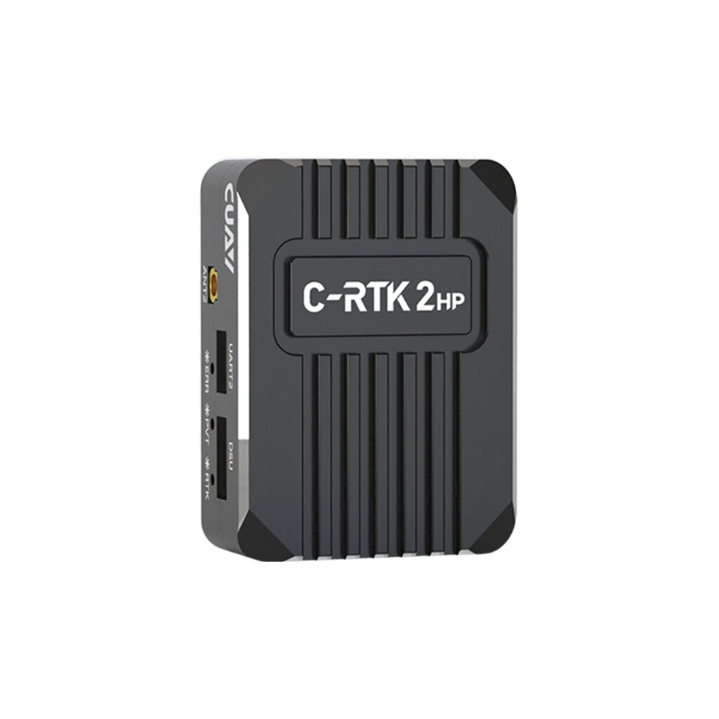
The C-RTK 2HP is a multi-constellation, multi-frequency, centimeter-level positioning and heading module. It utilizes a new-generation, high-performance GNSS SoC that integrates both baseband and RTK processing functions onto a single chip. Featuring superior data-handling capabilities and optimized multi-dimensional RTK matrix pipeline processing, it delivers an over 80% boost in RTK performance; it provides centimeter-level positioning using signals from over 50 satellites and achieves signal re-acquisition within one second. These features ensure continuous and reliable positioning and heading output, even in complex environments. The module integrates an STM32F4 processor—supporting DroneCAN protocol communication—along with a built-in RM3100 industrial-grade electronic compass and IMU sensor; its open-source design allows for the development of custom functions.

The C-RTK 9Ps is a quad-constellation, multi-frequency RTK positioning system that supports dual-module heading capabilities. It replaces the electronic compass in unmanned systems, enabling them to operate reliably in complex magnetic environments.
Supporting dual-module switching, it is a highly cost-effective, centimeter-level positioning module. It is an ideal choice for applications requiring real-time navigation, such as unmanned system aerial display, agricultural spraying, centimeter-level takeoff and landing, and ship-based operations.
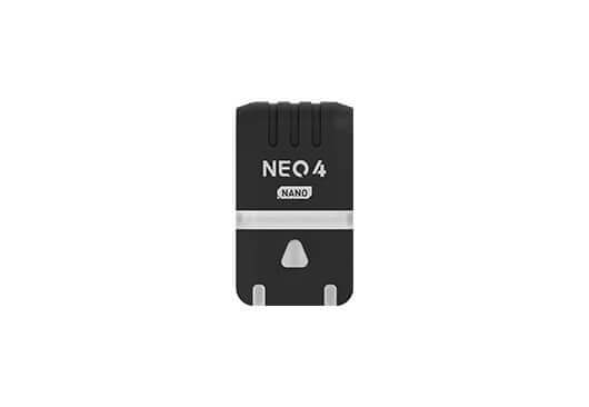
NEO 4 NANO is a micro satellite navigation receiver module. It features a highly integrated miniaturized design, integrating the u-blox M10 satellite receiver system and supporting concurrent reception of signals from four major positioning systems. It is equipped with a high-performance STM32H5 processor and an ST IIS2MDC electronic compass. It has accurate positioning and excellent anti-interference and environmental adaptability. It supports RGB full-color status indicators, which adopt the CAN bus protocol, and are widely applicable to various unmanned system devices.
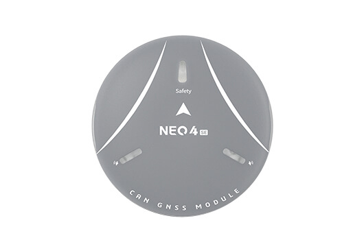
The NEO 4 SE is a high-performance single-point positioning module designed for unmanned systems. It integrates a u-blox 10th-generation centimeter-level GNSS receiver, a high-performance STM32H5 processor, an electronic compass, a safety switch, and an RGB status LED; it supports the DroneCAN protocol and is fully compatible with ArduPilot and PX4 firmware.
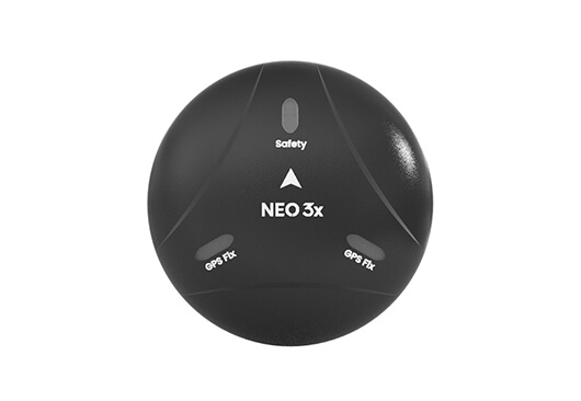
The NEO 3x is a quad-constellation GNSS receiver designed to withstand harsh environments. Built to the IP66 standard, it is sealed against dust and rain and integrates an STM32F4 series processor, an ICP2100 barometer, a u-blox M9N module, and an RM3100 industrial-grade electronic compass. It supports CAN bus communication based on the DroneCAN protocol, with a maximum communication range of 1.5 meters.
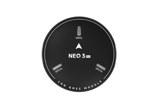
The NEO 3 Pro is an M9N navigation and positioning module that utilizes the DroneCAN communication protocol. It integrates a positioning system, an industrial-grade electronic compass, a controller status indicator, a buzzer, and a barometer into a single unit and is capable of simultaneously receiving signals from the four major satellite navigation systems.
How to Distinguish Between Different GNSS
CUAV Products | C-RTK 9Ps | C-RTK 2HP | C-RTK 2 |
| Product Type | Centimeter-Level Positioning Module | Centimeter-Level Positioning and Heading Module | RTK+PPK Centimeter-Level Positioning Module |
| Receiver Type | u-blox F9P | um982 | u-blox F9P |
| GNSS Bands | GPS: L1C/A、L2C GLONASS: L1OF、L2OF Galileo: E1B/C Galileo: E5b BeiDou: B1I、B2I | BeiDou: B1I、B2I、B3I GPS: L1C/A、L2P/L2C、L5 GLONASS: L1、L2 Galileo: E1、E5a、E5b | GPS:L1C/A,L2C GLONASS:L1OF,L2OF Galileo:E1B/C,E5b BeiDou:B1l,B2l |
| Position Accuracy | RTK: 0.01m+1ppm CEP Single Point: 1.5m CEP SBAS: 1.0m CEP | Single Point: 1.5m (Horizontal) /2.5m (Vertical) DGPS: 0.4m+1PPM (Horizontal) /0.8m+1PPM (Vertical) RTK: 0.8cm+1PPM (Horizontal) /1.5cm+1PPM (Vertical) | RTK Horizontal: 0.01m+1ppm (RMS) RTK Vertical: 0.02m+1ppm (RMS) Single Point Horizontal: 1.5m (RMS) |
| Dual-Antenna Direction Finding | Dual modules can form a dual-antenna direction finding system | Single Module Positioning and Heading | Not Support |
| Sensor | IST8310 | RM3100 | RM3100 |
| Operating Temperature | -40 ~ +85℃ | -20 ~ +85℃ | -20 ~ +85℃ |
| Weight | 30 g | 40 g | 39 g |
| Size | 47.0 × 32.0 × 12.2 mm | 50 × 37 × 17 mm | 56 × 33 × 16.5 mm |
CUAV Products | NEO 3 | NEO 3 Pro | NEO 3x | NEO 4 SE |
| Processor | / | STM32F412 | STM32F412 | STM32H5 |
| Sensor | IST8310 | RM3100 Barometer: ICP- 20100 | RM3100 Barometer: ICP- 20100 | llS2MDC |
| GNSS Receiver | u-blox M9N | u-blox M9N | u-blox M9N | u-blox M10Q |
| Frequency Band | GPS: L1C/A GLONASS: L10F BeiDou: B1I Galileo: E1B/C | GPS: L1C/A GLONASS: L10F BeiDou: B1I Galileo: E1B/C | GPS: L1C/A GLONASS: L10F BeiDou: B1I Galileo: E1B/C | GPS: L1C/A GLONASS: L10F BeiDou:B1I/B1C Galileo: E1B/C |
| Nav. Update Rate | 25Hz (MAX) | 25Hz (MAX) | 5Hz (Default), 25Hz (Max) | 5Hz (Default), 25Hz (Max) |
| Horizontal Accuracy | 2.0 m (Highest measured value is 0.7 m) | 2.0 m (Highest measured value is 0.7 m) | 1.5 m (Highest measured value is 0.7 m) | 1.5 m CEP |
| Acquisition | Cold Start:24s Hot Start:2s Aided Start:2s | Cold Start:24s Hot Start:2s Aided Start:2s | Cold Start:24s Hot Start:2s Aided Start:2s | Cold Start:27s Hot Start:1s Aided Start:1s |
| Protocol | UART+IO+I2C | DroneCAN | DroneCAN | DroneCAN |
| Wave Filtering | SAW+LNA+SAW | SAW+LNA+SAW | SAW+LNA+SAW | SAW+LNA+SAW+LNA |
| Input Voltage | 4.7 ~ 5.2 V | 4.7 ~ 5.2 V | 4.7 ~ 5.2 V | 4.7 ~ 5.2 V |
| Operating Temperature | -10 ~ +70 ℃ | -10 ~ +70 ℃ | -10 ~ +70 ℃ | -10 ~ +80 ℃ |
| Protection Level | / | / | IP66 | / |
| Size | 60 × 60 × 16 mm | 60 × 60 × 16 mm | 67.0 × 67.0 × 21.2 mm | 60 × 60 × 16.1 mm |
| Weight | 33 g | 33 g | 46 g (Cable Excluded) | 33 g |
